Comparison
Phuket or Krabi: which to choose
For travellers choosing a base on the Andaman coast.

Reviewed

Photo credit
Photo: Diego DelsoCC BY-SA 3.0Wikimedia Commons

The short answer
As of October 2026, choosing between these two Andaman coast destinations comes down to scale and mobility. Pick Phuket if you want a big island with distinct beach towns and heavy nightlife. Pick Krabi if you want a mainland province of limestone cliffs, on a smaller scale than Phuket, then choose your base inside it: Ao Nang for a beach strip of restaurants you can walk and boats to the islands, Krabi Town for the river and its markets, or Railay, which you reach by boat.
Which suits you
| Phuket | Krabi | |
|---|---|---|
| Best for | Nightlife, big malls and international dining | Limestone scenery and boat trips from Ao Nang to Railay and the islands |
| Feels like | A big island of beach towns split by steep hills | A mainland coast of limestone cliffs, with islands offshore |
| Getting around | Taxis, ride-hailing apps or a scooter | Songthaews between Ao Nang and Krabi Town; boats to Railay and the islands |
| Nights out | Neon-lit clubs on Bangla Road in Patong | A strip of restaurants and bars in Ao Nang |
How many places we list in each, from our own lists (the table says when they were counted):
Phuket
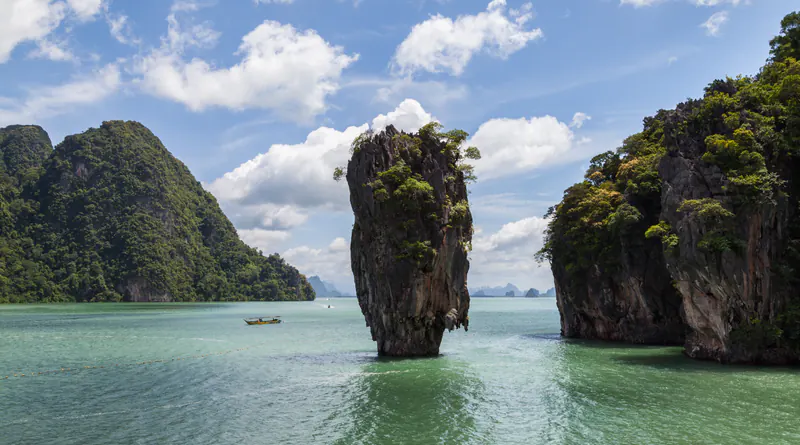
Photo credit
Photo: Diego DelsoCC BY-SA 3.0Wikimedia Commons

Phuket is Thailand’s largest island, measuring roughly 48 kilometres long and 21 kilometres wide. It connects to the mainland via the Sarasin Bridge in the north, where the international airport sits. The island is heavily developed, featuring distinct beach towns separated by steep hills, meaning you cannot easily walk between the different coastal areas. Local songthaew buses radiate from Phuket Town to the main beaches.
- Don’t miss
- Bangla Road: The neon-lit centre of Patong offers the heaviest concentration of late-night clubs.
- Phuket Town: Walk among Sino-Portuguese architecture and eat at dense clusters of local dining spots.
- Phang Nga Bay: Take a boat tour from the mangrove-lined east coast marinas to see the offshore islands.
- Weekend markets: Browse the large evening markets in Phuket Town for street food and clothes.
- Where to stay
- Patong suits those who want to be near the main nightlife, while Kata, Karon, and Kamala offer quieter sandy beaches further along the west coast.
Krabi
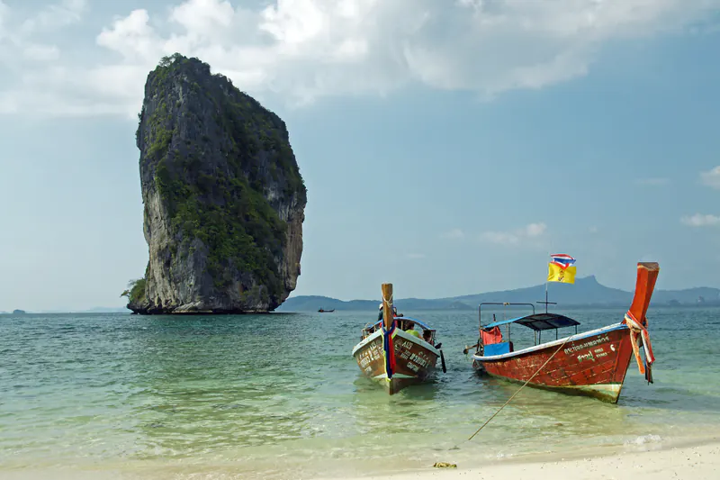
Photo credit
Photo: kallernaCC BY-SA 3.0Wikimedia Commons

Krabi is a mainland province east of Phuket, defined by vertical karst limestone cliffs that drop directly into the ocean. It operates its own international airport near the inland administrative centre of Krabi Town. The coastal areas feel much more compact than Phuket, and most visitors use them as a launchpad for offshore islands. Local songthaews run regularly between the beach areas and Krabi Town, taking about 30 to 45 minutes.
- Don’t miss
- Railay peninsula: Walk the sand and dirt paths of this roadless area, completely cut off by limestone cliffs.
- Island hopping: Catch ferries or speedboats straight to Koh Phi Phi and Koh Lanta; timetables change with the season, so check which run on your dates.
- Ao Nang beach: Use this long beach as your primary base for catching longtail boats.
- Krabi Town market: Visit the large walking street market on weekends by the Krabi River.
- Where to stay
- Ao Nang suits those who want a walkable strip of restaurants and easy transport, while Railay is for those who want a boat-access-only retreat.
Getting between them
Travelling between the two is straightforward; how long it takes depends on where you start and end, for example Patong or Phuket Town to Ao Nang or Krabi Town.
- Shared minivan: Minivans and buses run daily between the Phuket and Krabi bus terminals, taking about 3 to 4 hours.
- Private transfer: Taxis are faster and take roughly 2.5 to 3 hours, depending on traffic and your exact departure points.
- Ferry or speedboat: Boats operated by companies like Tigerline Ferry connect Phuket’s Rassada Pier with Krabi’s Ao Nang or Railay straight across Phang Nga Bay. They run to seasonal timetables (Tigerline publishes a separate one for the May to September monsoon), and rough seas can cancel sailings at short notice, so check the operator’s timetable for your date or take the road.
When to go
Both are on the Andaman coast, so their seasons follow the same broad pattern, but the monthly averages are not identical: September is the wettest month in both, at about 350 mm in Phuket and about 325 mm in Krabi. The dry season runs from roughly November to April, though November is still wet on average (about 220 to 230 mm). December to April is usually the better time for beach days and boat trips, though the sea still changes from day to day. The monsoon season runs from roughly May to October, bringing heavier rain and rough seas that can disrupt ferry schedules.
If your plans include a marine park, such as Maya Bay or the Similan Islands, our national park closures guide shows when each one closes. For a December or January trip, our December and January guides compare both with the rest of the country.
Frequently asked questions
Is Phuket or Krabi better for a first trip?
Phuket is generally easier for a first trip because of its size, international airport, and sheer variety of restaurants. Krabi is a better choice if your main goal is seeing dramatic limestone scenery and taking boat trips; Ao Nang is the usual base, with longtail boats to Railay leaving from the beach.
How do you get from Phuket to Krabi?
You can travel by road or by sea. Shared minivans take 3 to 4 hours, while private taxis take 2.5 to 3 hours. Ferries and speedboats also cross Phang Nga Bay on seasonal timetables; rough seas can cancel sailings, so check the operator’s timetable for your date.
Is Krabi quieter than Phuket?
Yes, Krabi operates on a much smaller scale. While Ao Nang has a concentrated strip of restaurants and bars, it lacks the big shopping malls, heavy traffic, and neon-lit nightclub streets found in Phuket’s Patong area.
When is the best time to visit Phuket and Krabi?
On average the driest months are December to April; November is still wet (about 220 to 230 mm) but drying out. The sea is usually calmer in the dry months, though not on every day, so check the Thai Meteorological Department’s 7-day forecast and the current ferry schedules to see which route fits your itinerary next.
Ready to pick?
Sources and checks
Drafted with help from an AI model, then fact-checked against the sources below and reviewed by Sajal on 17 Oct 2026.
Updated is the last change to what this guide says. Reviewed is when Sajal last checked it.
The numbers in the tables come from our own listings, counted when you open this page.
Sources
- Tourism Authority of Thailand: 10 things to do in Krabi (9 January 2020)
- Airports of Thailand: Phuket International Airport, about us (Mai Khao, Thalang)
- Wikipedia: Phuket province
- Wikipedia: Phuket International Airport
- Wikipedia: Krabi International Airport
- Tigerline Ferry: timetables (monsoon season May–September 2026; October 2025–April 2026)
- Thai Meteorological Department: shipping forecast
- Thai Meteorological Department: 7-day weather forecast
- NASA POWER climatology (MERRA-2, monthly means 2001–2020): air temperature (T2M) and rainfall (PRECTOTCORR) at Phuket (7.8804° N, 98.3381° E) and Krabi (8.0412° N, 98.8259° E)
Checked claims
- Phuket is Thailand's largest island, measuring roughly 48 kilometres long and 21 kilometres wide.
- It connects to the mainland via the Sarasin Bridge in the north, where the international airport sits.
- It operates its own international airport near the inland administrative centre of Krabi Town.
- November is still wet on average; December to April is usually the better time for beach days and boat trips, and the sea is usually calmer then, though not on every day.
- Krabi is a mainland province of limestone cliffs, on a smaller scale than Phuket; the reader picks a base inside it: Ao Nang (a beach strip of restaurants you can walk, boats to the islands), Krabi Town (the river and its markets) or Railay (reached by boat). Songthaews link Ao Nang and Krabi Town; boats go to Railay and the islands.
- Phuket and Krabi follow the same broad Andaman pattern, but the monthly averages differ: September is the wettest month in both, about 350 mm in Phuket and about 325 mm in Krabi.
- Boats between Phuket's Rassada Pier and Ao Nang or Railay run to seasonal timetables (Tigerline publishes a separate one for the May to September monsoon); rough seas can cancel sailings, so check the operator's timetable for your date or take the road.
- The monsoon season runs from roughly May to October, bringing heavier rain and rough seas that can disrupt ferry schedules.
- Krabi operates on a much smaller scale than Phuket.
Confirmed: the source supports it; qualified: no source can promise this, so it is worded as something to check. Each check was AI-assisted: “by web search” means a search found the source, “source read” means the source itself was opened and read.
Changes to this guide
First published .
- : Krabi bases and counts made precise: the short answer, table and FAQ name Ao Nang, Krabi Town and Railay as the bases rather than calling the whole province walkable; the rounded villa counts are replaced by our live counts table; the weather line now gives each place its own September average from our climate data (Phuket about 350 mm, Krabi about 325 mm); the unmeasured road distance is removed.
- : Links added beside the reader's next decision: when to go links the national park closures guide (Maya Bay and the Similan Islands) and the December and January guides. No facts changed; the new sentences only point to those guides.
- : Sources made claim-specific: the Tourism Authority of Thailand homepage became its Krabi article and the Tigerline homepage its timetable page; the Thai Meteorological Department, Airports of Thailand and Department of Airports homepages are gone (the TMD forecast pages and the Phuket airport page stay); bare domains now carry page titles. The land-development seasons page, a Phuket provincial page and a Krabi airport report could not be used and are gone. The boat crossing no longer gives a time we could not check on the operator's timetable: it says the boats run to seasonal timetables and rough seas can cancel sailings. Climate figures now name NASA POWER's dataset (MERRA-2 monthly means, 2001–2020), its temperature and rainfall parameters and each place's coordinates, and link that place's exact data query instead of the NASA POWER homepage.
- : Weather and boat advice made conditional: November is still wet on average, December to April the drier months; no calm-sea or ideal-conditions promise; island boats are seasonal; links to TMD's 7-day forecast and shipping forecast.
- : New card layout reviewed and published by Sajal.
- : Each point said once: the repeated short-answer bullets and the per-place "Best for", "Pick this if" and "Skip this if" lines are gone, their facts kept in the comparison table (villa counts from our listings, rounded).
- : Said once: the "at a glance" strip only repeated the "Which suits you" table and is gone. No new claims.
- : The monsoon tip folded into the ferry bullet. No new claims.
- : Rewritten in its own tone; 9 facts checked by web search with sources, 4 still to check by a person.
- : 0 more facts confirmed by web search (sources added); 4 left for a person to check.
- : Reviewed and published by Sajal.
- : Restructured into destination cards from the published version; new claims marked for checking.
- : 1 more facts confirmed by web search (sources added); 0 left for a person to check.
- : 30 more facts confirmed by web search (sources added); 10 left for a person to check.
- : AI-assisted draft; not yet checked.